
A lot of my “art” is rooted in science and history. I don’t know why but when I think of sweep I immediately think “radar”.
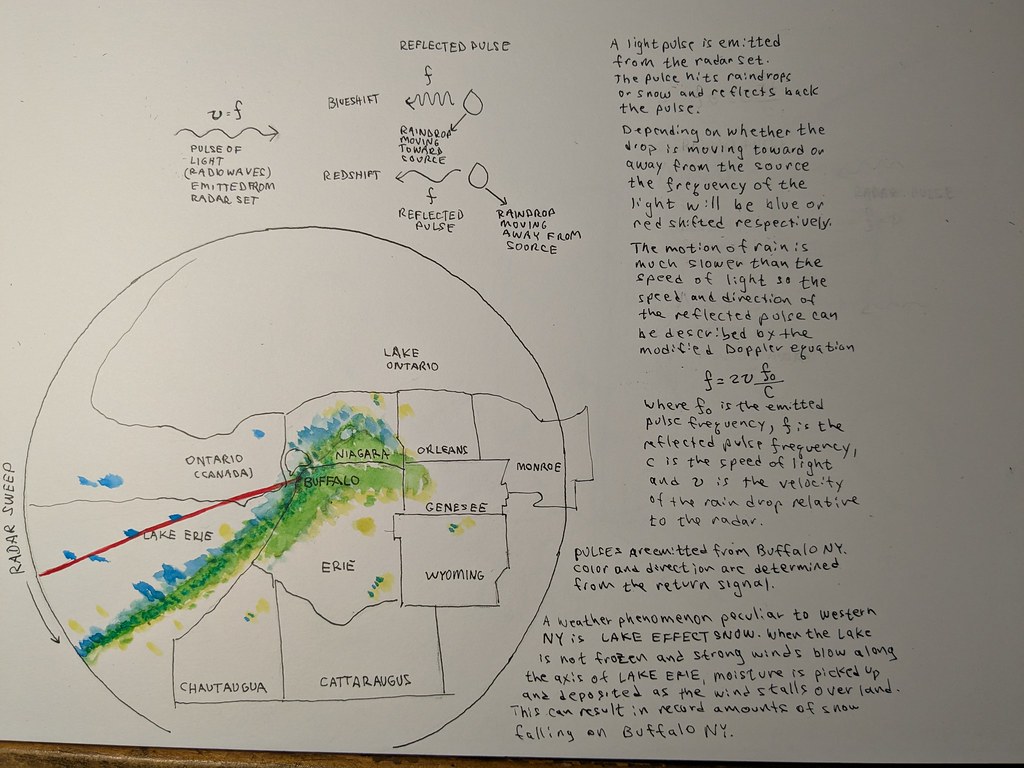
Doppler radar is critical for weather for casting. The radar set emits a pulse of radio frequency energy that goes out and if it hits precipitation… water droplets or snow or hail it reflects some of the energy back toward the radar receiving antenna. If the water is moving away from the source the light wave is slightly elongated (made lower energy – or red-shifted). If the droplet is moving towards the source it will shorten the reflected pulse (make the energy of the pulse larger – or blue-shifted). This change in frequency tells how fast the droplets are moving toward or away from the source. The density of signal tells the amount of precipitation. This tool helps forecasters to see precipitation move and evolve over time. Pretty fascinating stuff. Created in WWII for automated guns, then for tracking aircraft and target seeking missiles…this is one of society’s biggest benefits from science.
In Buffalo NY we get these occasional storms, called Lake Effect Snow. These are particular to Western NY and other West Coast, Great Lake States.
In short wind moves over the open water picking up moisture. When the wind hits land it loses energy and can no longer hold the moisture and deposits it for a few miles until it dissipates. The inland communities are spared from this.
Once in a while the wind lines up along the axis of Lake Erie – as happened in Dec 2022. Lake Erie is long and skinny and the amount of moisture that can accumulate as the wind travels the length of the lake (approximately NE) is huge. In the radar it looks like a cigar-shaped blob of precipitation aimed at Buffalo NY.